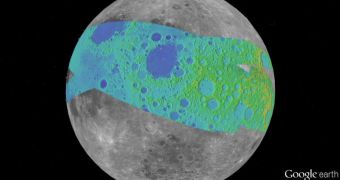
Experts at the NASA Ames Research Center, in Moffett Field, California, have recently created a new series of image processing algorithms that allow them to process photos collected by the Apollo missions to the Moon in a way that was not even thought possible before.
Using the grayscale pixels in the photos as a starting point, the ARC team is developing 3D mosaics of digital photos from the datasets collected by the Apollo Metric Camera. The instrument was installed onboard the Apollo 15, 16 and 17 spacecraft.
Each grayscale pixel looks like an either black, white or gray square when viewed up close. Using each square as a building block, experts can now construct digital versions of the old photos. The new algorithms can also clear out the imperfect static images Apollo-era cameras took.
The NASA Lunar Mapping and Modeling Portal (LMMP) and the Google Moon feature in Google Earth now provide users with the ability to see the newly-created Apollo Zone Digital Image Mosaic (DIM) and Digital Terrain Model (DTM) maps for themselves.
The datasets cover no more than 18 percent of the entire lunar surface, but they provide a resolution level of 98 feet (30 meters) per pixel. Experts at the ARC Intelligent Robotics Group (IRG) are to be commended for this amazing accomplishment.
“The main challenge of the Apollo Zone project was that we had very old data – scans, not captured in digital format,” explains IRG senior scientist Ara Nefian. She also holds an appointment at the Carnegie Mellon University (CMU) in Silicon Valley.
“They were taken with the technology we had over 40 years ago with imprecise camera positions, orientations and exposure time by today’s standards,” the expert goes on to say. But the ARC algorithms can now automatically generate 2D and 3D maps based on those images.
IRG director Terry Fong says that “the key innovation that we made was to create a fully automatic image mosaicking and terrain modeling software system for orbital imagery.”
“We have since released this software in several open-source libraries including Ames Stereo Pipeline, Neo-Geography Toolkit and NASA Vision Workbench,” Fong concludes.

 14 DAY TRIAL //