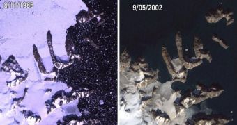
Officials at the US National Aeronautics and Space Administration (NASA) and the United States Geological Survey (USGS) are proud to announce the 40th anniversary of the Landsat satellite constellation, which is the basis of the longest Earth-observing space program ever conducted.
The first Landsat spacecraft was launched to space aboard a Delta 900 delivery system, on July 23, 1972, from the Vandenberg Air Force Base (VAFB), in California. Experts say that this vehicle was a modified version of the Nimbus 4 meteorological satellite.
One of the things that have made spacecraft in this constellation so successful is that they do not simply snap pictures of the planet's surface. The datasets they relay back to Earth contain multiple layers, each of which is compiled from different wavelengths of light.
Landsat satellites have the ability to obtain optical and near-infrared images, and combine them in comprehensive maps that can detail the status of several hundreds of thousands of acres of grassland, agricultural crops or forests at the same time.
Over the last 40 years, the Landsat program has launched 7 spacecraft, of which only Landsat 6 – launched in 1993 – failed to reach orbit. Currently, only Landsat 5 (1984) and Landsat 7 (1999) continue to operate 400 miles (643.7 kilometers) above the planet, each suffering from severe technical problems.
The continued coverage these satellites ensured led to the creation of the most comprehensive database of Earth observations ever created. Studies conducted on this information led to changes in the way we understand the environment, water and energy management, agriculture, urban planning and so on.
“Landsat has given us a critical perspective on our planet over the long term and will continue to help us understand the big picture of Earth and its changes from space. With this view we are better prepared to take action on the ground and be better stewards of our home,” NASA Administrator Charles Bolden says.
“Over four decades, data from the Landsat series of satellites have become a vital reference worldwide for advancing our understanding of the science of the land,” explains Ken Salazar, the Secretary of the Interior Department, which manages the USGS.
“The 40-year Landsat archive forms an indelible and objective register of America's natural heritage and thus it has become part of this department's legacy to the American people,” the official concludes.

 14 DAY TRIAL //