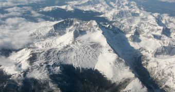
Isotopic ratio analyses conducted on old raindrops have revealed that the onset of a large wave of mountain building began more than 49 million years ago in British Columbia, Canada. The work also showed that the phenomenon then began rolling southwards, towards Mexico.
The ancient raindrops that were used to derive this conclusions were sampled from soils and lake sediments at various locations by researchers at the Stanford University, in the United States.
One of the major implications of the new discoveries is proving the idea that a Tibet-like plateau once existed in North America to be false. For many years, experts believed that the erosion of such structure produced the mountains we can observe today.
Stanford geochemists say that the wave of mountain formation began in Canada, but add that, over the next 22 million years, it spread to Mexico, and as far east as modern-day Nebraska. Geologically speaking, the event took place very fast.
The previous theory had it that a massive plateau developed in the western United States, as well as in Canada and Mexico, and also that simultaneous erosion taking place in all these areas at once carved up the modern mountain ranges.
In order to get a clear picture of what actually happened, the research team analyzed the isotopic ratios of chemicals in raindrops that fell to the Earth from 65 to 28 million years ago. This basically means that they covered a time span that began immediately after the dinosaurs disappeared.
“Where we got a huge jump in isotopic ratios, we interpret that as a big uplift. We saw a major isotopic shift at around 49 million years ago, in southwest Montana,” explains expert Hari Mix.
The team discovered “another one at 39 MYA, in northern Nevada,” which scientists interpreted as being the southward motion of the uplift, adds Mix. He is a PhD candidate in Environmental Earth System Science at the university.
“The pattern of topographic uplift we found matches what has been documented by other people in terms of the volcanology and extension,” the expert goes on to say.
“There was a big north to south sweep of volcanism through the western US at the exact same time,” he adds, saying that the new data match a number of other simulations of what happened at the time.
“The main implication of this work is that it was not a plateau that collapsed, but rather something that happened in the mantle, that was causing this mountain growth,” explains Mix's PhD advisor, Page Chamberlain.
The expert holds an appointment as a professor in environmental Earth system science at the university. The PhD candidate presented the results of this research yesterday, December 17, at the 2010 annual fall meeting of the American Geophysical Union, held in San Francisco.

 14 DAY TRIAL //