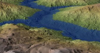
Investigators analyzing the history of California's Eel River have recently determined that the water course was at one point a large lake, which was created after the usual flow was blocked by a tremendous landslide.
Scientists say that evidence of this can be found everywhere in the basin, especially by those who know where to look. In order to confirm its discovery, the team used a variety of scientific techniques, including airborne Light Detection and Ranging (LIDAR) measurements.
In addition, team members also carried out surveys using handheld GPS receivers. All techniques used corroborated the idea that a massive landslide blocked the course of the river some 22,500 years ago.
The obstacle was about 400 feet (122 meters) high, and was made up of loosely-bound rocks, logs, vegetation, sand and other types of debris. The river could not penetrate it right away, so water began accumulating behind the block.
Eventually, the river turned into a 30-mile (48.2-kilometer) long lake, which has since disappeared, but which left behind telltale signs of its existence. Identifying such a formation is a walk in the park for geologists, especially in this mountainous region.
The area is renowned for the fact that it is changing at a very fast pace, in geological terms. Details of the new study were published in this week's online issue of the esteemed journal Proceedings of the National Academy of Sciences (PNAS).
“This study reminds us that there are still significant surprises to be unearthed about past landscape dynamics and their broad impacts,” explains scientist Paul Cutler. He is a program director in the Division of Earth Sciences at the National Science Foundation (NSF).
“For example, it provides valuable information for assessing modern landslide hazard potential in this region,” adds the official. The DES provided the funding required for this study, which was conducted by experts at the California Institute of Technology (Caltech).
“Perhaps of most interest, the presence of this landslide dam also provides an explanation for the results of previous research on the genetics of steelhead trout in the Eel River” says Caltech investigator and lead study author Benjamin Mackey.
He adds that the dam most likely had significant influence over the entire landscape, altering the way in which species were accustomed to utilize this space. Fish that were used to swim upstream for the mating season began mingling with other species, with which they had no correlation before.
These shifts concluded once the dam ruptured, and former migration and land use patterns resumed.
“Although current physical evidence for the landslide dam and ancient lake is subtle, its effects are recorded in the Pacific Ocean and persist in the genetic make-up of today's Eel River steelhead. It's rare for scientists to be able to connect the dots between such diverse phenomena,” Joshua Roering says.
The expert holds an appointment as a geologist at the University of Oregon, and was also a coauthor of the PNAS paper.

 14 DAY TRIAL //