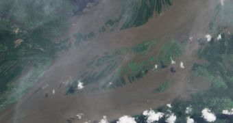
Experts have determined a long time ago that the Amazon River, as one of the largest bodies of flowing water in the world, plays an important part in the world's water cycle. They therefore set out to investigate how the river's floods influence its volume and spread throughout the floodplains. The satellite data experts used painted an interesting picture of what's going on when the Amazon exceeds its boundaries. Apparently, the river can swell to more than half the volume of Lake Erie.
This is one of the five Great Lakes at the US-Canadian border, which are remnants of a massive glacial lake that covered the entire region millennia ago. But, even if the Brazilian river grows to half the volume of the world's 15th largest lake, its floods represent only a 5 percent annual increase in the amount of water flowing through it. Scientists were very surprised to learn this, as they were expecting to see a much more significant difference. The latest measurements show that the amount of water passing yearly through the Amazon River floodplain equals 68 cubic miles (285 cubic kilometers).
“Nobody knows exactly how much water there is on the planet. We need to understand how our water supply will change as the climate changes, and the first step is getting a handle on how much water we actually have,” explains geologist Doug Alsdorf. The expert, who was a member of team behind the new investigation, is based at the Ohio State University (OSU). “Satellite observations are the only reliable option for places like the Amazon and especially the Congo Basin, where in-person measurements are near-impossible. Just getting there is a serious challenge,” Alsdorf adds.
He explains that the recent study is only the first in a series that should cover the largest bodies of water in the world. Determining volume variations affecting floodplains is essential for predicting how global warming and climate change would influence water flows in the future. This could be useful for devising methods of protecting against floods, or for informing decision on creating new irrigation systems, to compensate for potential water loss. Details of the latest investigation appear in the June 30 online issue of the respected journal Remote Sensing of Environment, LiveScience reports.

 14 DAY TRIAL //