14 DAY TRIAL //
 The scientific consensus is that Mars had surface water, in abundance, up to a couple of billion years ago. The planet dried out of course, and scientists are very curious why, but at some point the planet had lakes and even rivers flowing on it. Just like on Earth, these water bodies left marks, some more subtle than others.
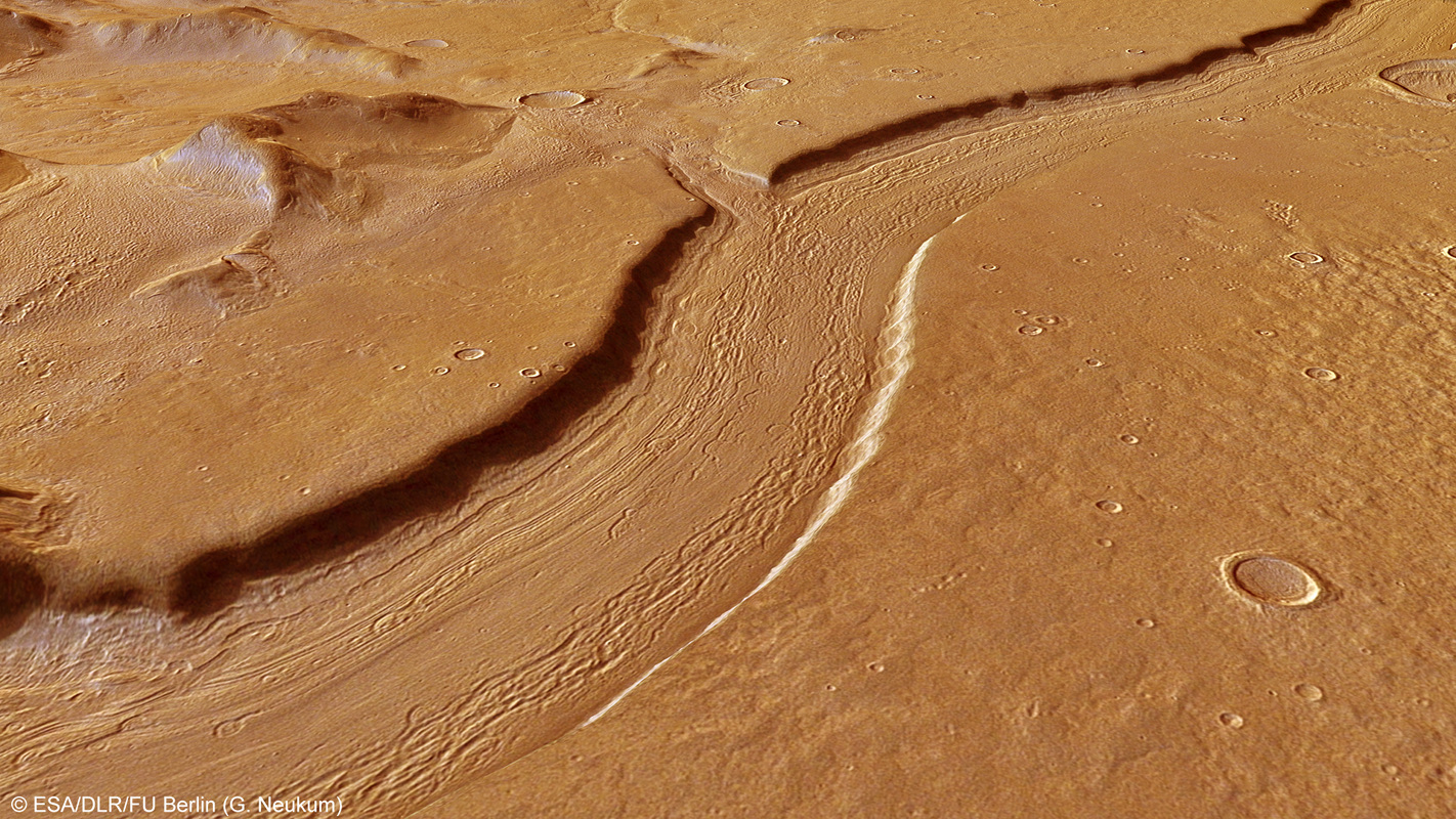
The riverbed image that ESA's Mars Express provided recently is one of the less subtle ones. In fact, anyone seeing it would assume that some river created it.
Granted, just because it looks like it was created by something doesn't make it true, but in this case scientists would agree with the uninformed observant.
The structure seen in the image is dubbed Reull Vallis and is believed to have been created by a river over millions of years. It's quite huge, at some 1,500 km long, so it was one big river.
In fact, tributaries can be seen quite clearly in the image and others astronomers have gotten from the nearby planet.
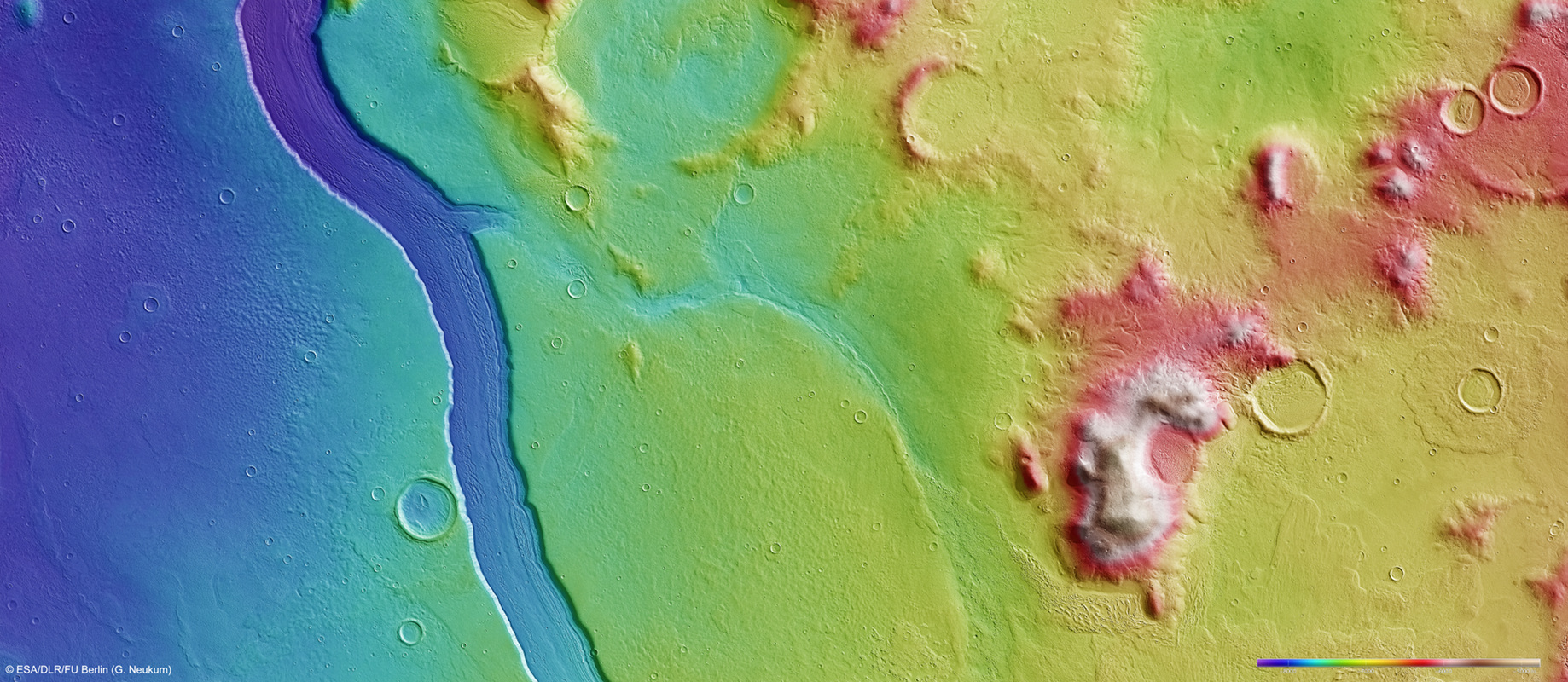
The second image in the gallery provides an even better perspective of the point where the tributary merged with the larger river. Finally, the topographic image makes the depth differences much clearer.
The region actually holds even more clues to Mars' past as the presumed riverbed shows some step-like features that are believed to have been created by glaciers long after there was no more running water on the surface. The lineated features are very similar to the ones created by glaciers on Earth.