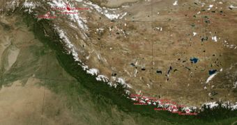
An image released by the American space agency today, January 28, shows all of the world's tallest mountain peaks in a single image. The view includes the fourteen mountains on Earth that are taller than 8,000 meters, or 26,246 feet.
This composite image was put together from data collected over 11 days, in February 2000, during the Shuttle Radar Topography Mission (SRTM) flown by the NASA space shuttle Endeavour.
The international research effort was based on a heavily-modified radar system based on the Spaceborne Imaging Radar-C/X-band Synthetic Aperture Radar (SIR-C/X-SAR), which first flew in 1994.
The fourteen tallest mountains on Earth – Shisha Pangma, Gasherbrum II, Broad Peak, Gasherbrum I, Annapurna, Nanga Parbat, Manaslu, Dhaulagiri, Cho Oyu, Makalu, Lhotse, Kangchenjunga, K2, and Mount Everest – are shared between the Karakoram and Himalaya mountain ranges.
The Himalayas are some of the most important mountains in the world, having significantly influenced the culture of Asia. The three major rivers that originate in these mountains – the Indus, the Ganges and the Tsangpo-Brahmaputra – provide water and sustenance for 600 million people.

 14 DAY TRIAL //