A collaboration of American researchers has recently created a new type of carbon-mapping technology, that they say can be used to map the reserves of the chemical in Hawaii's forests.
The group details its achievement in the latest online issue of the scientific journal Frontiers in Ecology and the Environment. The team included experts from the Carnegie Institution for Science and the US Department of Agriculture (USDA).
Determining the amount of carbon stored in forests throughout the United States has become a top priority for private and public organization, as these entities are interested in entering the carbon offset market, which is currently experiencing a boom.
In order for the system to work, and for businesses to make a profit, experts need to be able to accurately quantify the amount of carbon stored in forests. The data is then used to calculate the value of offsets, therefore playing an important role in this economic sector.
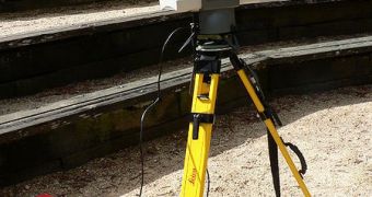
In a bid to answer that call, the collaboration used a combination of airborne Light Detection And Ranging (LiDAR)–based observations, field measurements and satellite imagery to look at the forest occupying the Island of Hawaii.
This resulted in the creation of a 30-meter resolution map covering 1 million hectares (2.47 million acres). The dataset includes readings for 40 types of vegetation, and the analysis reveals the existence of some 28.3 million tons of carbon sequestered above the ground.
This value is 56 percent lower than that estimated by the UN Intergovernmental Panel on Climate Change (IPCC). In all fairness, the UN organization was not intended to be able to resolve carbon concentrations with such advanced local resolution.
Scientists with the CIW Department of Global Ecology and the USDA Forest Service's Pacific Southwest Research Station (PSW) say that the method could be fine-tuned for use in other areas around the world as well.
“This research demonstrates that ecosystem [carbon] stocks can be accurately assessed in highly variable environments across extensive geographic regions,” explains scientist Dr. R. Flint Hughes.
“We are very excited about the prospects of applying this new approach to other regions of the world to facilitate faster and more accurate forest [carbon] assessments It is a true leap forward in understanding the state and dynamics of the world's forests,” he adds. \
Hughes is a coauthor of the new research paper. He holds an appointment as a research ecologist at the PSW Ecosystem Function and Health Program.

 14 DAY TRIAL //