 14 DAY TRIAL //
 They did not even know what struck them, but a tsunami was what hit an England shore 400 years ago, bringing about the deadliest natural disaster in the British history.
The massive flood on January 30, 1607 went over the Bristol Channel (southwestern England), submerging over 190 square miles (500 square km) of land, causing 2,000 victims and by that time the cause of the disaster was a freak storm surge. Still, researchers warn that U.K. remains vulnerable to another such disaster, even more deadly.
"It is certainly something that could happen again, and today the impact would be far worse," said study co-author Simon Haslett, a geologist at Britain's Bath Spa University.
"There is a real risk, and the U.K. should have a tsunami warning system."
The researchers detected proofs of their theory in gigantic boulders located along the Channel shore.
"We found boulders the size of small cars, stacked in chains like roof tiles. Transporting these boulders would require a prolonged current and couldn't be the work of a storm. We spotted also unusual erosion features in the channel's bedrock that can't be explained by wave erosion. These [features] were caused by whirlpools pulling up cobbles [round stones], which acted like a drill to erode doughnut-shaped depressions in the rock," Haslett explained.
Such patterns are the result of water between 33 and 197 ft (10-60 m) deep, unlikely to be the result of a storm surge.
Based on the wasted energy, the researchers found that the tsunami was 20 ft (6 m) tall at the channel's narrowest point and had a speed of 38.7-59.3 ft (11.8-18.1 m) per second. This matches the historical descriptions of "mighty hilles of water" and a wave that is "affirmed to have runne ? with a swiftness so incredible, as that no gray-hounde could have escaped by running before them."
The cause could have been an underwater earthquake or landslide.
"An active fault zone lies off the coast of Ireland, and second-hand reports mention a tremor felt on the morning of January 30, 1607," Haslett said.
The Bristol Channel is believed to have suffered the most as the local patterns produced a magnification effect.
"The Bristol Channel gets very narrow at one point, which funnels the water and would have amplified the wave," Haslett said.
Kevin Horsburgh of the Proudman Oceanographic Laboratory in Liverpool still advocates the storm variant. He believes that the bedrock traits can be determined by the channel's strong currents.
"Bristol Channel has the second largest tide in the world and tidal currents of up to 8 m (26 ft) per second [26 feet a second], twice a day, every day," he said.
But he, too, agrees that tsunamis still represent an imminent risk.
The most recent tsunami recorded in British history is that following the Lisbon earthquake in 1755 that hit southwestern England.
A huge tsunami was found to have hit the Shetland Islands (Scotland) and eastern coast 8,000 years ago, due to a large underwater landslide off Norway. But a mega-tsunami is expected to occur on the Canary Islands.
"Our research has shown that the world's biggest active landslide is occurring on the flanks of Cumbre Vieja, a volcano on the Canary Island of La Palma," said Bill McGuire, director of the Benfield Hazard Research Center at University College London.
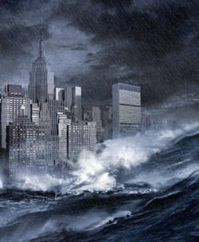
In case of an eruption, half of the island would slide into the Atlantic Ocean and the consequent tsunami would hit the East Coast of the US and large portions of Western European shore with waves up to 33 ft (10 m).
"One day this eruption will occur. It is a case of when, not if. About 2 % of tsunamis occur in the Atlantic Ocean, but this figure could become higher in the future. If global warming causes catastrophic melting of the Greenland ice sheet, then we can expect large landslides to occur from the glacial sediment sitting offshore," explained McGuire.