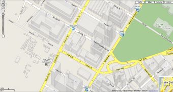
Google tries to improve Google Maps periodically because it is very important to keep the service up to date and provide a powerful alternative for the downloadable Google Earth. Because the offline application was often brought in the spotlights, it's now Google Maps' turn, the search giant revealing a new set of photos able to improve the quality of the service. As you can see in the picture attached to the article, Google Maps now shows 2D building for multiple US cities. The images are well designed and, if you compare them with the real pictures captured through the satellite, you're able to see they are really similar to the real ones. According to Google Maps Mania blog, the new update was released for approximately 38 US cities and is accessible only from zoom level 1 or 2.
"A few days ago the Geo group at Google has taken this feature a step further by enhancing the dimensional look of these buildings and structures. Previously building structures appeared in a flat format. This has now been improved to a sort of "2.5 D" effect. The update has been applied to approximately 38 US cities, so get on Google Maps, zoom right down onto levels 1 and 2 and take a look around!" the blogger said.
The parent company Google recently introduced a new feature for Google Maps, codenamed My Maps, able to allow users to create their own maps using the elements displayed by the online service. Since the release of the feature, numerous users designed their own maps, managing to create exciting graphical representations of certain locations. Take for example the mashup created by Haochi, a Google blogger, who built a map with the Google officers from all around the world.

 14 DAY TRIAL //